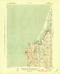
1944 Map of Empire
USGS Topo · Published 1944About this map
Coos Bay and the coastal shelf of the Siuslaw National Forest define this 1940s landscape, where the maritime economy meets a deeply inland-reaching tidal network. At the bay's mouth, the village of Charleston sits opposite the North Spit, while the community of Empire anchors the eastern shore near the North Bend city boundary. This era captures a transition from purely extractive land use to early conservation and public recreation, evidenced by the Arago Lighthouse and the establishment of Cape Arago State Park. Inland, the map reveals a dense network of family-operated agricultural holdings, including the Oldland, Sengstacken, and Frye Ranch, which follow the winding path of the South Slough. The industrial presence is marked by a pulp mill and the Chickamin Mine, while local education is represented by the Beach View and South Slough schools.
Find a feature on this map
67 named features on this map. Tap any name to fly to it.
Don’t see what you’re looking for? This feature index may not catch every label — zoom into the map to look around manually.
Map Details
Editions of this 1944 Empire Map
4 editions found
Other maps of this area

1896 · Coos Bay
USGS Topo · 1:125,000

1898 · Coos Bay
USGS Topo · 1:125,000

1900 · Coos Bay
USGS Topo · 1:125,000

1923 · Reedsport
USGS Topo · 1:62,500

1942 · Reedsport
USGS Topo · 1:62,500

1942 · Empire
USGS Topo · 1:62,500

1942 · Coquille
USGS Topo · 1:62,500

1942 · Coos Bay
USGS Topo · 1:62,500

1943 · Bandon
USGS Topo · 1:62,500

1944 · Empire
USGS Topo · 1:62,500