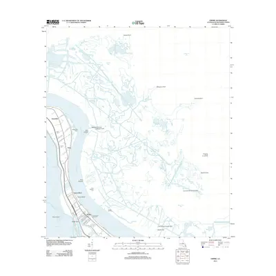
2012 Map of Empire
USGS Topo · Published 2012About this map
Mississippi River shipping routes and the energy industry define this coastal landscape near the edge of the Gulf. The settlements of Empire, Tropical Bend, and Nairn cling to the narrow strip of land between the river and the marsh, supported by a network of local roads such as Backlevee Rd and Galmiche Ln. Significant river engineering is evident at the Ballandock Structure and the Tropical Bend Revetment, which protect the vital transit corridor.
Find a feature on this map
63 named features on this map. Tap any name to fly to it.
Don’t see what you’re looking for? This feature index may not catch every label — zoom into the map to look around manually.
Map Details
Editions of this 2012 Empire Map
This is the sole edition of this map. No revisions or reprints were ever made.
Other maps of this area

1892 · Quarantine
USGS Topo · 1:62,500

1893 · La Fortuna
USGS Topo · 1:62,500

1893 · Forts
USGS Topo · 1:62,500

1893 · Dime
USGS Topo · 1:62,500

1935 · Port Sulphur
USGS Topo · 1:31,680

1935 · Bastian Bay
USGS Topo · 1:31,680

1935 · Tropical Bend
USGS Topo · 1:31,680

1941 · Black Bay
USGS Topo · 1:62,500

1941 · Empire
USGS Topo · 1:62,500
1944 · Black Bay
USGS Topo · 1:62,500