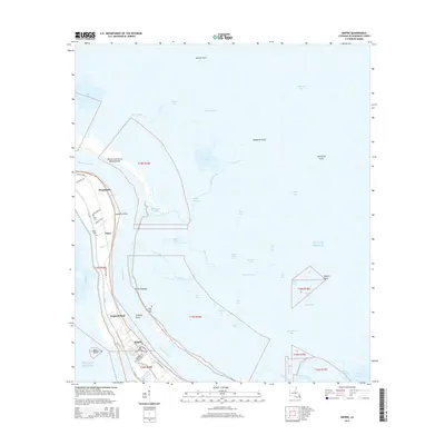
2015 Map of Empire
USGS Topo · Published 2015About this map
The Mississippi River snakes through the heart of Plaquemines Parish in this 2015 study, defining a landscape where narrow ribbons of habitable land are flanked by sprawling marsh and open water. The settlement of Empire anchors the southern portion of the sheet, characterized by its commercial waterway access via Doullut Canal and its proximity to the Gulf Of Mexico. Moving north along the river's western bank, the communities of Tropical Bend, Nairn, and Hesperides follow the path of La 23, illustrating the traditional linear settlement pattern common to the Mississippi delta.
Find a feature on this map
64 named features on this map. Tap any name to fly to it.
Don’t see what you’re looking for? This feature index may not catch every label — zoom into the map to look around manually.
Map Details
Editions of this 2015 Empire Map
This is the sole edition of this map. No revisions or reprints were ever made.
Other maps of this area

1892 · Quarantine
USGS Topo · 1:62,500

1893 · La Fortuna
USGS Topo · 1:62,500

1893 · Forts
USGS Topo · 1:62,500

1893 · Dime
USGS Topo · 1:62,500

1935 · Port Sulphur
USGS Topo · 1:31,680

1935 · Bastian Bay
USGS Topo · 1:31,680

1935 · Tropical Bend
USGS Topo · 1:31,680

1941 · Black Bay
USGS Topo · 1:62,500

1941 · Empire
USGS Topo · 1:62,500
1944 · Black Bay
USGS Topo · 1:62,500