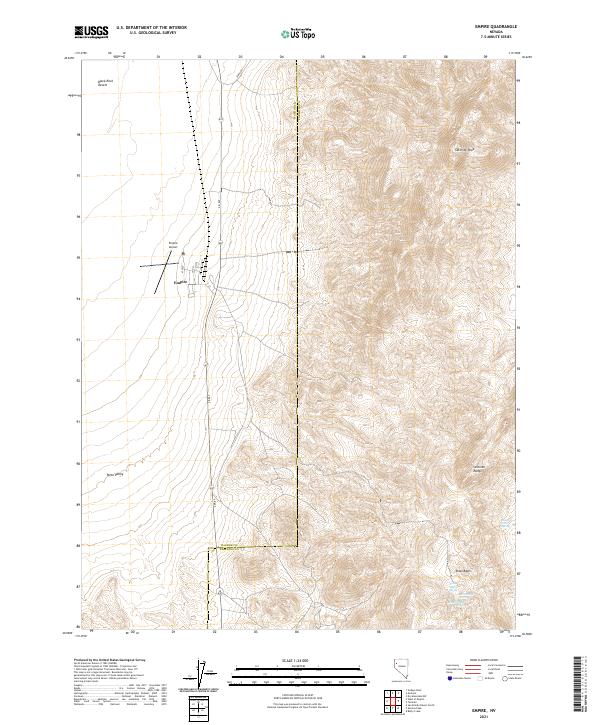
2021 Map of Empire
USGS Topo · Published 2021About this map
Empire stands as the primary settlement in this high desert landscape, positioned along S R 447 where the valley floor meets the rising peaks. The town layout is clearly defined by local streets such as 4th St, 2nd St, and C St, with the Empire Airport serving this remote northern Nevada community. The terrain is dramatically split between the flat expanse of the Black Rock Desert and Poito Valley to the west and the formidable heights of the Selenite Range to the east, anchored by Selenite Peak. To the southeast, the Texas Basin area contains several vital water sources, including Texas Basin Spring, Last Chance Spring, and Double Spout Spring, which are critical landmarks in an otherwise arid environment. The transition between Washoe Co and Pershing Co is also documented here, following the desert's natural contours.
Find a feature on this map
25 named features on this map. Tap any name to fly to it.
Don’t see what you’re looking for? This feature index may not catch every label — zoom into the map to look around manually.
Map Details
Editions of this 2021 Empire Map
This is the sole edition of this map. No revisions or reprints were ever made.
Other maps of this area

1886 · Granite Range
USGS Topo · 1:250,000

1894 · Granite Range
USGS Topo · 1:250,000

1955 · Lovelock
USGS Topo · 1:250,000

1959 · Lovelock
USGS Topo · 1:250,000

1964 · Gerlach
USGS Topo · 1:62,500

1964 · Kumiva Peak
USGS Topo · 1:62,500

1980 · Dry Mountain NW
USGS Topo · 1:24,000

1980 · Tenmile
USGS Topo · 1:24,000

1981 · Gerlach
USGS Topo · 1:100,000
1981 · Betty Creek
USGS Topo · 1:24,000