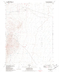
1981 Map of Betty Creek
USGS Topo · Published 1982About this map
The high ridges of the Selenite Range dominate this Nevada landscape, descending steeply into the broad expanse of the Kumiva Valley. This 1981 survey, based on 1970s aerial photography, reveals a remote high-desert environment where water sources are the primary indicators of human activity and survival. Sparse but critical landmarks include Desert Well and a simple Corral, alongside named springs like Redwood Spring, Lookout Spring, and Desert Spring.
Find a feature on this map
18 named features on this map. Tap any name to fly to it.
Don’t see what you’re looking for? This feature index may not catch every label — zoom into the map to look around manually.
Map Details
Editions of this 1981 Betty Creek Map
2 editions found
Other maps of this area

1886 · Granite Range
USGS Topo · 1:250,000

1894 · Granite Range
USGS Topo · 1:250,000

1955 · Lovelock
USGS Topo · 1:250,000

1959 · Lovelock
USGS Topo · 1:250,000

1964 · Gerlach
USGS Topo · 1:62,500

1964 · Kumiva Peak
USGS Topo · 1:62,500

1980 · Eagle Rock Spring
USGS Topo · 1:24,000

1980 · Tenmile
USGS Topo · 1:24,000

1981 · Twin Buttes Well
USGS Topo · 1:24,000

1981 · Gerlach
USGS Topo · 1:100,000