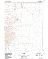
1981 Map of Betty Creek
USGS Topo · Published 1985About this map
Selenite Range peaks and high-desert basins define this part of Pershing County during the early 1980s. The landscape is marked by the scarce but critical water sources that supported livestock and early mining efforts, including Desert Spring, Redwood Spring, and the seasonally active Little Meadow Creek. The intersection of geology and industry is evident at the Prospect located near Deer Canyon, reflecting the persistent search for mineral wealth in the Great Basin.
Find a feature on this map
18 named features on this map. Tap any name to fly to it.
Don’t see what you’re looking for? This feature index may not catch every label — zoom into the map to look around manually.
Map Details
Editions of this 1981 Betty Creek Map
2 editions found
Other maps of this area

1886 · Granite Range
USGS Topo · 1:250,000

1894 · Granite Range
USGS Topo · 1:250,000

1955 · Lovelock
USGS Topo · 1:250,000

1959 · Lovelock
USGS Topo · 1:250,000

1964 · Gerlach
USGS Topo · 1:62,500

1964 · Kumiva Peak
USGS Topo · 1:62,500

1980 · Eagle Rock Spring
USGS Topo · 1:24,000

1980 · Tenmile
USGS Topo · 1:24,000

1981 · Twin Buttes Well
USGS Topo · 1:24,000

1981 · Gerlach
USGS Topo · 1:100,000