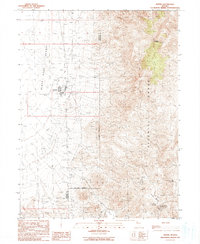
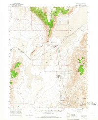
1990 Map of Empire
USGS Topo · Published 1990About this map
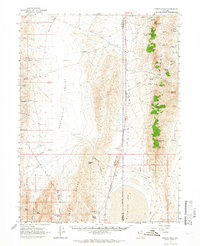
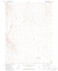
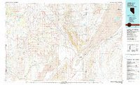
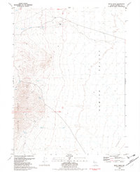
Empire stands as a focal point of industrial and municipal activity on the western edge of the Selenite Range during the late 20th century. The settlement is characterized by its utilitarian infrastructure, including a Landing Strip, Tanks, and a Golf Course, all positioned where the foothills meet the expansive Black Rock Desert. This 1990 provisional survey highlights the intersection of resource extraction and desert life, showing numerous Borrow Pits, a Quarry, and various Prospect sites scattered across the transition from the valley floor to the high elevations of Selenite Peak.
Find a feature on this map
25 named features on this map. Tap any name to fly to it.
Don’t see what you’re looking for? This feature index may not catch every label — zoom into the map to look around manually.
Map Details
Editions of this 1990 Empire Map
This is the sole edition of this map. No revisions or reprints were ever made.
Other maps of this area

1886 · Granite Range
USGS Topo · 1:250,000

1894 · Granite Range
USGS Topo · 1:250,000

1955 · Lovelock
USGS Topo · 1:250,000

1959 · Lovelock
USGS Topo · 1:250,000
1964 · Gerlach
USGS Topo · 1:62,500
1964 · Kumiva Peak
USGS Topo · 1:62,500

1980 · Dry Mountain NW
USGS Topo · 1:24,000
1980 · Tenmile
USGS Topo · 1:24,000
1981 · Gerlach
USGS Topo · 1:100,000
1981 · Betty Creek
USGS Topo · 1:24,000