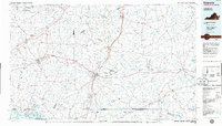
1984 Map of Emporia
USGS Topo · Published 1986About this map
Emporia serves as a central hub in this mid-1980s portrait of Southside Virginia, where the intersection of Interstate 95 and U S Hwy 58 highlights the region's evolving transportation network. The landscape is defined by its numerous watercourses, most notably the Meherrin River and Nottoway River, which meander through a region dotted with historic sites like Fort Christanna near Lawrenceville. To the northwest, the map captures a portion of the Fort Pickett Military Reservation, while the southern edge touches the waters of Lake Gaston at the North Carolina border.
Find a feature on this map
123 named features on this map. Tap any name to fly to it.
Don’t see what you’re looking for? This feature index may not catch every label — zoom into the map to look around manually.
Map Details
Editions of this 1984 Emporia Map
This is the sole edition of this map. No revisions or reprints were ever made.
Other maps of this area

1891 · Farmville
USGS Topo · 1:125,000

1893 · Farmville
USGS Topo · 1:125,000

1894 · Petersburg
USGS Topo · 1:62,500

1897 · Amelia
USGS Topo · 1:125,000

1908 · Winton
USGS Topo · 1:62,500

1918 · Lawrenceville
USGS Topo · 1:62,500

1919 · Jarratt
USGS Topo · 1:62,500

1919 · Surry
USGS Topo · 1:62,500

1919 · Mc Kenney
USGS Topo · 1:48,000

1919 · Disputanta
USGS Topo · 1:62,500