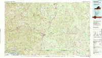
1990 Map of Emporia
USGS Topo · Published 1990About this map
Emporia stands as a central transit hub in this 1990 survey, situated at the convergence of major highways and rail lines where the Piedmont begins to give way to the coastal plain. The landscape is defined by the winding courses of the Meherrin River and Nottoway River, which carve through a mosaic of agricultural lands and dense woodlands. The industrial and transport backbone of the region is clearly visible through the routes of the Seaboard System Railroad and the Norfolk Southern Railway, linking settlements like Lawrenceville, Jarratt, and Courtland. To the southwest, the upper reaches of Lake Gaston along the Roanoke River mark the border with North Carolina, while eastern sections are characterized by significant wetlands such as Assamoosick Swamp and Seacock Swamp, reflecting the low-lying terrain of the Virginia Southside.
Find a feature on this map
75 named features on this map. Tap any name to fly to it.
Don’t see what you’re looking for? This feature index may not catch every label — zoom into the map to look around manually.
Map Details
Editions of this 1990 Emporia Map
This is the sole edition of this map. No revisions or reprints were ever made.
Other maps of this area

1891 · Farmville
USGS Topo · 1:125,000

1893 · Farmville
USGS Topo · 1:125,000

1894 · Petersburg
USGS Topo · 1:62,500

1897 · Amelia
USGS Topo · 1:125,000

1908 · Winton
USGS Topo · 1:62,500

1918 · Lawrenceville
USGS Topo · 1:62,500

1919 · Jarratt
USGS Topo · 1:62,500

1919 · Surry
USGS Topo · 1:62,500

1919 · Mc Kenney
USGS Topo · 1:48,000

1919 · Disputanta
USGS Topo · 1:62,500