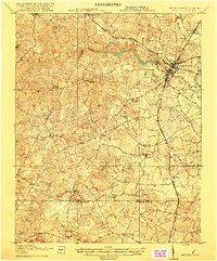
1919 Map of Emporia
USGS Topo · Published 1919About this map
The Meherrin River cuts across the northern landscape of this Southside Virginia region, serving as a primary drainage point for a network of creeks and swamps just above the North Carolina border. This 1918 survey documents the dual commercial hubs of Emporia and North Emporia, where the Atlantic Coast Line and the Southern Railway (Danville Line) intersect. This rail junction drove the local economy, connecting rural outposts and family-run operations like Webbs Mill and Cornwalls Mill to broader markets.
Find a feature on this map
55 named features on this map. Tap any name to fly to it.
Don’t see what you’re looking for? This feature index may not catch every label — zoom into the map to look around manually.
Map Details
Editions of this 1919 Emporia Map
3 editions found
Other maps of this area

1918 · Lawrenceville
USGS Topo · 1:62,500

1919 · Jarratt
USGS Topo · 1:62,500

1919 · Mc Kenney
USGS Topo · 1:48,000

1919 · White Plains
USGS Topo · 1:48,000

1919 · Emporia
USGS Topo · 1:62,500

1919 · Arringdale
USGS Topo · 1:48,000

1920 · Lawrenceville
USGS Topo · 1:48,000

1920 · White Plains
USGS Topo · 1:62,500

1920 · Arringdale
USGS Topo · 1:62,500

1921 · Mc Kenney
USGS Topo · 1:62,500