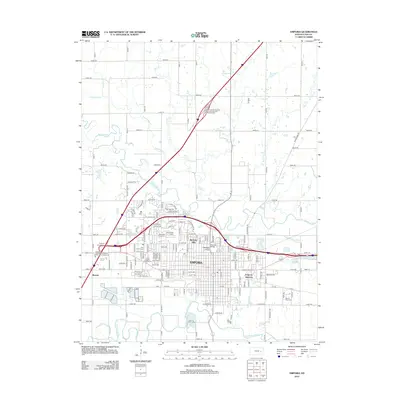
2012 Map of Emporia
USGS Topo · Published 2012About this map
The Neosho River and Cottonwood River converge near the heart of Lyon County, framing the regional hub of Emporia. This 2012 survey illustrates the town's mature footprint, anchored by the Emporia State University campus and major transport corridors like the Kansas Turnpike. Settlement patterns extend into suburban developments such as Berkeley Hills and Hills Village, while the city's agricultural and industrial roots remain evident at the Lyon County Fairgrounds and the Emporia Junction rail intersection. Local heritage is preserved in several large grounds, including Maplewood Cem and Memorial Lawn Cem. The surrounding landscape is defined by the winding paths of Allen Creek and Troublesome Creek, which cut through the grid of county roads that serve the outlying community of Merrick.
Find a feature on this map
142 named features on this map. Tap any name to fly to it.
Don’t see what you’re looking for? This feature index may not catch every label — zoom into the map to look around manually.
Map Details
Editions of this 2012 Emporia Map
This is the sole edition of this map. No revisions or reprints were ever made.
Other maps of this area

1885 · Eskridge
USGS Topo · 1:125,000

1888 · Emporia
USGS Topo · 1:125,000

1889 · Eskridge
USGS Topo · 1:125,000

1894 · Emporia
USGS Topo · 1:125,000

1894 · Eskridge
USGS Topo · 1:125,000

1955 · Hutchinson
USGS Topo · 1:250,000

1957 · Lang
USGS Topo · 1:24,000

1957 · Emporia
USGS Topo · 1:24,000

1957 · Plymouth
USGS Topo · 1:24,000

1959 · Hutchinson
USGS Topo · 1:250,000