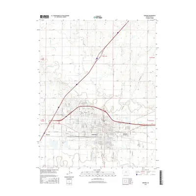
2015 Map of Emporia
USGS Topo · Published 2015About this map
The Emporia city grid sits at the confluence of the Neosho River and the Cottonwood River, serving as a regional hub for education and commerce. This survey captures the extensive campus of Emporia State Univ near Wooster Lake and the Flint Hills Technical Coll on the western edge of town. The landscape is defined by the convergence of major transportation lines at Emporia Junction and the small outlying settlement of Merrick. Local history and genealogy are well-represented by several large interment sites, including Maplewood Cem, Memorial Lawn Cem, and Sacred Heart Cem. The surrounding topography is marked by a network of creeks such as Troublesome Cr, Allen Cr, and Taylor Cr which drain the plains toward the primary river valleys.
Find a feature on this map
78 named features on this map. Tap any name to fly to it.
Don’t see what you’re looking for? This feature index may not catch every label — zoom into the map to look around manually.
Map Details
Editions of this 2015 Emporia Map
This is the sole edition of this map. No revisions or reprints were ever made.
Other maps of this area

1885 · Eskridge
USGS Topo · 1:125,000

1888 · Emporia
USGS Topo · 1:125,000

1889 · Eskridge
USGS Topo · 1:125,000

1894 · Emporia
USGS Topo · 1:125,000

1894 · Eskridge
USGS Topo · 1:125,000

1955 · Hutchinson
USGS Topo · 1:250,000

1957 · Lang
USGS Topo · 1:24,000

1957 · Emporia
USGS Topo · 1:24,000

1957 · Plymouth
USGS Topo · 1:24,000

1959 · Hutchinson
USGS Topo · 1:250,000