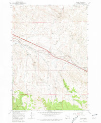
1967 Map of Encina
USGS Topo · Published 1981About this map
Mining and rail activity define this corner of Baker County during the late 1960s, where the Union Pacific railroad cuts a diagonal path through the high desert terrain. The settlement of Encina serves as a central point along this corridor, situated near the confluence of Dry Creek and Dry Gulch. To the southeast, Pleasant Valley marks the continuing route of the tracks and a secondary cluster of development.
Find a feature on this map
34 named features on this map. Tap any name to fly to it.
Don’t see what you’re looking for? This feature index may not catch every label — zoom into the map to look around manually.
Map Details
Editions of this 1967 Encina Map
4 editions found
Other maps of this area

1901 · Baker City
USGS Topo · 1:125,000

1955 · Baker
USGS Topo · 1:250,000

1959 · Baker
USGS Topo · 1:250,000

1967 · Virtue Flat
USGS Topo · 1:24,000

1967 · Encina
USGS Topo · 1:24,000

1967 · Baker
USGS Topo · 1:24,000
1967 · Keating
USGS Topo · 1:24,000

1967 · French Gulch
USGS Topo · 1:24,000

1967 · Dooley Mtn
USGS Topo · 1:24,000

1967 · Lost Basin
USGS Topo · 1:24,000