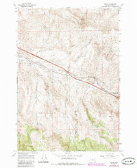
1967 Map of Encina
USGS Topo · Published 1985About this map
The Union Pacific railroad corridor anchors this landscape in eastern Oregon, following the path of Dry Creek past the small settlements of Encina and Pleasant Valley. This mid-century survey reflects a region defined by its transit routes and mineral extraction, with a persistent network of jeep trails and trails navigating the complex drainage systems of Quartz Gulch and Dogtown Gulch.
Find a feature on this map
29 named features on this map. Tap any name to fly to it.
Don’t see what you’re looking for? This feature index may not catch every label — zoom into the map to look around manually.
Map Details
Editions of this 1967 Encina Map
4 editions found
Other maps of this area

1901 · Baker City
USGS Topo · 1:125,000

1955 · Baker
USGS Topo · 1:250,000

1959 · Baker
USGS Topo · 1:250,000

1967 · Virtue Flat
USGS Topo · 1:24,000

1967 · Encina
USGS Topo · 1:24,000

1967 · Baker
USGS Topo · 1:24,000
1967 · Keating
USGS Topo · 1:24,000

1967 · French Gulch
USGS Topo · 1:24,000

1967 · Dooley Mtn
USGS Topo · 1:24,000

1967 · Lost Basin
USGS Topo · 1:24,000