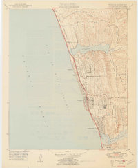
1949 Map of Encinitas
USGS Topo · Published 1949About this map
Coastal settlements along the Gulf of Santa Catalina are defined by the linear progress of the Atchison Topeka and Santa Fe railroad and the Coast Highway in this late 1940s survey. The landscape is punctuated by significant tidal features, including Batiquitos Lagoon to the north and San Elijo Lagoon at the southern edge, which hem in the growing communities of Leucadia, Encinitas, and Cardiff-by-the-Sea.
Find a feature on this map
19 named features on this map. Tap any name to fly to it.
Don’t see what you’re looking for? This feature index may not catch every label — zoom into the map to look around manually.
Map Details
Editions of this 1949 Encinitas Map
2 editions found
Other maps of this area

1893 · Oceanside
USGS Topo · 1:62,500

1893 · Escondido
USGS Topo · 1:62,500

1898 · Oceanside
USGS Topo · 1:62,500

1901 · Escondido
USGS Topo · 1:62,500

1901 · Oceanside
USGS Topo · 1:62,500

1901 · San Luis Rey
USGS Topo · 1:125,000

1903 · La Jolla
USGS Topo · 1:62,500

1904 · Southern California Sheet No. 2
USGS Topo · 1:250,000

1930 · La Jolla
USGS Topo · 1:62,500
1942 · Oceanside
USGS Topo · 1:62,500