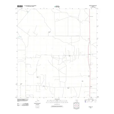
2010 Map of Encino
USGS Topo · Published 2010About this map
Vallerreno Cemetery and Longoria Cemetery stand as quiet landmarks in this ranching and energy landscape south of Falfurrias. The community of Encino serves as a central point along US Hwy 281 Bus, surrounded by established family-named properties including Escondido Ranch, Tepeguaje Ranch, and Skipper Ranch. The economy of the South Texas brush country is clearly visible through the extensive infrastructure of the Rachal Oil Field and the Alta Mesa East Oil Field, alongside the transportation corridor of the Rachal Siding. Water features like Round Lake and Medio Lake punctuate the landscape, while a network of rural routes such as Las Cuatas Rd and Huppergate Rd connect the scattered ranching outposts and settlements like Rachal and Plano de Choche.
Find a feature on this map
23 named features on this map. Tap any name to fly to it.
Don’t see what you’re looking for? This feature index may not catch every label — zoom into the map to look around manually.
Map Details
Editions of this 2010 Encino Map
This is the sole edition of this map. No revisions or reprints were ever made.
Other maps of this area

1921 · Falfurrias
USGS Topo · 1:125,000

1939 · Encantada
USGS Topo · 1:62,500

1949 · Mc Allen
USGS Topo · 1:250,000

1954 · McAllen
USGS Topo · 1:250,000

1956 · Laredo
USGS Topo · 1:250,000

1957 · Mc Allen
USGS Topo · 1:250,000

1962 · McAllen
USGS Topo · 1:250,000

1963 · Falfurrias SE
USGS Topo · 1:24,000

1963 · Cage Ranch
USGS Topo · 1:24,000
1963 · Callo Padrones
USGS Topo · 1:24,000