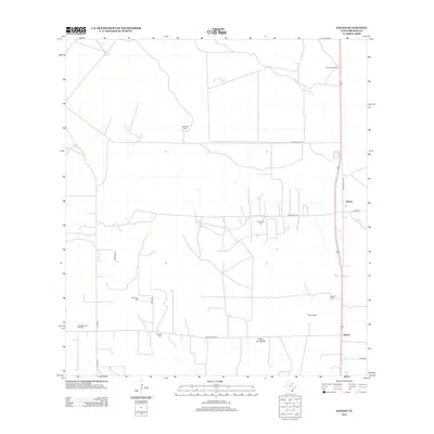
2012 Map of Encino
USGS Topo · Published 2012About this map
Encino and the surrounding ranchlands of Brooks County characterize this South Texas landscape during the early 21st century. The map reveals a region defined by extensive landholdings and energy extraction, with the Rachal Oil Field and Alta Mesa East Oil Field marking the industrial footprint on the brush country. Settlement is sparse, clustered around the community of Rachal and established outposts like Escondido Ranch and Tepeguaje Ranch.
Find a feature on this map
23 named features on this map. Tap any name to fly to it.
Don’t see what you’re looking for? This feature index may not catch every label — zoom into the map to look around manually.
Map Details
Editions of this 2012 Encino Map
This is the sole edition of this map. No revisions or reprints were ever made.
Other maps of this area
1921 · Falfurrias
USGS Topo · 1:125,000
1939 · Encantada
USGS Topo · 1:62,500
1949 · Mc Allen
USGS Topo · 1:250,000
1954 · McAllen
USGS Topo · 1:250,000
1956 · Laredo
USGS Topo · 1:250,000
1957 · Mc Allen
USGS Topo · 1:250,000
1962 · McAllen
USGS Topo · 1:250,000
1963 · Falfurrias SE
USGS Topo · 1:24,000
1963 · Cage Ranch
USGS Topo · 1:24,000
1963 · Callo Padrones
USGS Topo · 1:24,000