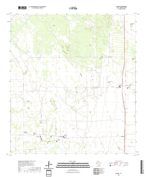
2022 Map of Encino
USGS Topo · Published 2022About this map
The coastal plains of Brooks County are defined here by a dense concentration of family burial grounds and ranching pastures. This landscape, primarily organized by the cattle industry, includes expansive tracts such as Los Muertos Pasture and Remuda Pasture. The small settlement of Rachal sits along the eastern edge, serving as a focal point for the surrounding rural territory.
Find a feature on this map
33 named features on this map. Tap any name to fly to it.
Don’t see what you’re looking for? This feature index may not catch every label — zoom into the map to look around manually.
Map Details
Editions of this 2022 Encino Map
This is the sole edition of this map. No revisions or reprints were ever made.
Other maps of this area

1921 · Falfurrias
USGS Topo · 1:125,000

1939 · Encantada
USGS Topo · 1:62,500

1949 · Mc Allen
USGS Topo · 1:250,000

1954 · McAllen
USGS Topo · 1:250,000

1956 · Laredo
USGS Topo · 1:250,000

1957 · Mc Allen
USGS Topo · 1:250,000

1962 · McAllen
USGS Topo · 1:250,000

1963 · Falfurrias SE
USGS Topo · 1:24,000

1963 · Cage Ranch
USGS Topo · 1:24,000
1963 · Callo Padrones
USGS Topo · 1:24,000