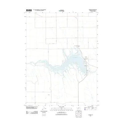
2011 Map of Enders
USGS Topo · Published 2011About this map
Enders Reservoir dominates this landscape in Chase County, formed by the construction of Enders Dam along Frenchman Creek. The settlement of Enders sits just north of the water, anchored by the Enders Post Office. This 2011 survey reflects the area's development as a regional recreation hub, with infrastructure including the Area A Campground, the Enders Lake Golf Course, and its associated RV Park. The surrounding terrain is defined by a rigid grid of rural routes such as 736 RD and 338 Ave, which slice through the plains to serve the agricultural hinterland. The map provides a clear view of the intersection between water management and local community life in this western Nebraska corridor.
Find a feature on this map
23 named features on this map. Tap any name to fly to it.
Don’t see what you’re looking for? This feature index may not catch every label — zoom into the map to look around manually.
Map Details
Editions of this 2011 Enders Map
This is the sole edition of this map. No revisions or reprints were ever made.
Other maps of this area

1954 · McCook
USGS Topo · 1:250,000

1957 · McCook
USGS Topo · 1:250,000

1958 · McCook
USGS Topo · 1:250,000

1973 · Champion
USGS Topo · 1:24,000

1973 · Enders
USGS Topo · 1:24,000

1973 · Champion SW
USGS Topo · 1:24,000

1973 · Imperial
USGS Topo · 1:24,000

1973 · Ough
USGS Topo · 1:24,000

1973 · Wauneta SW
USGS Topo · 1:24,000

1973 · Imperial Municipal Airport
USGS Topo · 1:24,000