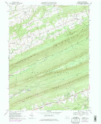
1969 Map of Enders
USGS Topo · Published 1984About this map
The ridge-and-valley landscape of northern Dauphin County is defined here by a series of parallel crests including Peters Mountain, Third Mountain, and Second Mountain. This 1960s survey records the rural character of the region before significant modernization, showing small agricultural and residential centers like Enders, Enterline, and Waynesville. Industrial history is preserved in labels for Victoria Furnace and Ellendale Forge, hinting at the area's early iron production, while the Old RR Grade south of Stony Creek marks the path of former transport routes through the gaps.
Find a feature on this map
58 named features on this map. Tap any name to fly to it.
Don’t see what you’re looking for? This feature index may not catch every label — zoom into the map to look around manually.
Map Details
Editions of this 1969 Enders Map
4 editions found
Other maps of this area

1892 · Lykens
USGS Topo · 1:62,500

1892 · Hummelstown
USGS Topo · 1:62,500

1892 · Harrisburg
USGS Topo · 1:62,500

1893 · Lykens
USGS Topo · 1:62,500

1893 · Millersburg
USGS Topo · 1:62,500

1899 · Harrisburg
USGS Topo · 1:62,500

1924 · Hummelstown
USGS Topo · 1:62,500

1924 · Harrisburg
USGS Topo · 1:62,500

1943 · Millersburg
USGS Topo · 1:62,500

1943 · Lykens
USGS Topo · 1:62,500
Featured Places
- Jackson Township, PA
- Jefferson Township, PA
- West Hanover Township, PA
- Rush Township, PA
- Middle Paxton Township, PA