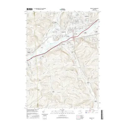
2016 Map of Endicott
USGS Topo · Published 2016About this map
The Susquehanna River defines the geography of this mid-2010s study, serving as a corridor for major infrastructure such as the Thomas J Watson Memorial Bridge and the Susquehanna River Bridge. Urban development is concentrated in the northern valley, where Endicott and Endwell form a dense residential and industrial belt. South of the river, the landscape rises into a series of prominent hills, including Grippen Hill and Bolles Hill, where the settlement pattern shifts to more dispersed communities like Vestal Center and Tracy Creek. For genealogists and local historians, the map identifies several significant burial grounds, from the large Riverhurst Cem and Riverside Cem near the water's edge to the more secluded Tracy Creek Cem. The Tri-Cities Airport occupies a level terrace in the river bend, illustrating the region's continued reliance on the valley floor for transportation hubs.
Find a feature on this map
45 named features on this map. Tap any name to fly to it.
Don’t see what you’re looking for? This feature index may not catch every label — zoom into the map to look around manually.
Map Details
Editions of this 2016 Endicott Map
This is the sole edition of this map. No revisions or reprints were ever made.
Other maps of this area

1901 · Apalachin
USGS Topo · 1:62,500

1904 · Binghamton
USGS Topo · 1:62,500

1904 · Apalachin
USGS Topo · 1:62,500

1906 · Catatonk
USGS Topo · 1:125,000

1934 · Castle Creek
USGS Topo · 1:24,000

1935 · Binghamton West
USGS Topo · 1:24,000

1942 · Binghamton West
USGS Topo · 1:31,680

1942 · Castle Creek
USGS Topo · 1:31,680

1943 · Montrose
USGS Topo · 1:62,500

1943 · Le Raysville
USGS Topo · 1:62,500