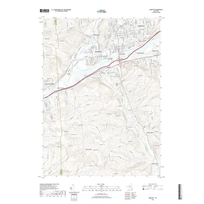
2019 Map of Endicott
USGS Topo · Published 2019About this map
The Susquehanna River serves as the central artery for this part of Broome County, dividing the industrial and residential density of Endicott and Endwell from the southern townships. Multiple crossings, including the Thomas J Watson Memorial Bridge and the Susquehanna River Bridge, facilitate the flow between these communities. North of the river, the landscape is defined by established neighborhoods and local landmarks like Riverside Cem and Saint Mary's Orthodox Catholic Cem.
Find a feature on this map
46 named features on this map. Tap any name to fly to it.
Don’t see what you’re looking for? This feature index may not catch every label — zoom into the map to look around manually.
Map Details
Editions of this 2019 Endicott Map
This is the sole edition of this map. No revisions or reprints were ever made.
Other maps of this area

1901 · Apalachin
USGS Topo · 1:62,500

1904 · Binghamton
USGS Topo · 1:62,500

1904 · Apalachin
USGS Topo · 1:62,500

1906 · Catatonk
USGS Topo · 1:125,000

1934 · Castle Creek
USGS Topo · 1:24,000

1935 · Binghamton West
USGS Topo · 1:24,000

1942 · Binghamton West
USGS Topo · 1:31,680

1942 · Castle Creek
USGS Topo · 1:31,680

1943 · Montrose
USGS Topo · 1:62,500

1943 · Le Raysville
USGS Topo · 1:62,500