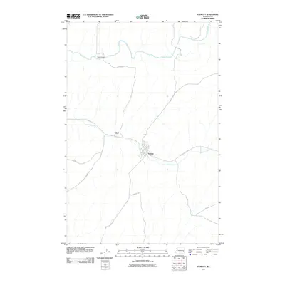
2011 Map of Endicott
USGS Topo · Published 2011About this map
Endicott serves as the central hub of this eastern Washington landscape, situated where Rebel Flat Creek winds through the surrounding hills. This 2011 survey illustrates the town's grid, including streets like Margin St and G St, while the nearby Endicott Airport indicates the modern infrastructure supporting this rural community. The terrain is defined by the winding course of the Palouse River to the north, which is crossed by the Fisher Bridge. A network of thoroughfares like Kackman Rd, Endicott St John Rd, and Swent Rd connect the town to the broader Whitman County agricultural region. The map captures a high-resolution view of the area's drainage and road systems, documenting the precise spatial layout of a classic Palouse wheat-belt town at the beginning of the 21st century.
Find a feature on this map
22 named features on this map. Tap any name to fly to it.
Don’t see what you’re looking for? This feature index may not catch every label — zoom into the map to look around manually.
Map Details
Editions of this 2011 Endicott Map
This is the sole edition of this map. No revisions or reprints were ever made.
Other maps of this area

1950 · La Crosse
USGS Topo · 1:62,500

1950 · Endicott
USGS Topo · 1:62,500

1952 · La Crosse
USGS Topo · 1:62,500

1955 · Pullman
USGS Topo · 1:250,000

1955 · Spokane
USGS Topo · 1:250,000

1958 · Spokane
USGS Topo · 1:250,000

1958 · Pullman
USGS Topo · 1:250,000

1964 · St. John
USGS Topo · 1:24,000

1964 · Texas Lake
USGS Topo · 1:24,000

1964 · Ewan
USGS Topo · 1:24,000