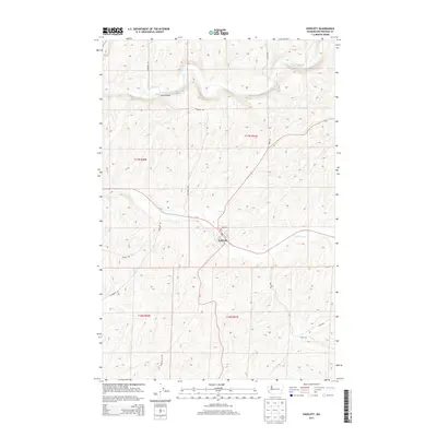
2013 Map of Endicott
USGS Topo · Published 2013About this map
Endicott serves as the central hub of this Whitman County landscape, situated where the seasonal waters of Rebel Flat Cr meet the local road network. The map reveals a distinct division between the higher plateau land and the carved valley of the Palouse River, which flows across the northern portion of the quadrangle. In this agricultural region, the transition between township ranges like t17n r41e and t17n r40e is marked by a series of winding rural routes and family-named landmarks. Navigation across the river is facilitated by the Fisher Bridge, while the town itself is organized around a grid including D St and Margin St. The placement of Repp Rd and Kaiser Rd reflects the long-standing transportation patterns essential for the movement of goods and people across the rolling hills of the Palouse.
Find a feature on this map
19 named features on this map. Tap any name to fly to it.
Don’t see what you’re looking for? This feature index may not catch every label — zoom into the map to look around manually.
Map Details
Editions of this 2013 Endicott Map
This is the sole edition of this map. No revisions or reprints were ever made.
Other maps of this area

1950 · La Crosse
USGS Topo · 1:62,500

1950 · Endicott
USGS Topo · 1:62,500

1952 · La Crosse
USGS Topo · 1:62,500

1955 · Pullman
USGS Topo · 1:250,000

1955 · Spokane
USGS Topo · 1:250,000

1958 · Spokane
USGS Topo · 1:250,000

1958 · Pullman
USGS Topo · 1:250,000

1964 · St. John
USGS Topo · 1:24,000

1964 · Texas Lake
USGS Topo · 1:24,000

1964 · Ewan
USGS Topo · 1:24,000