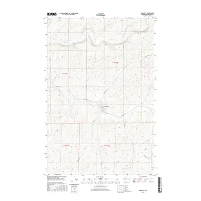
2017 Map of Endicott
USGS Topo · Published 2017About this map
Endicott serves as the primary hub in this Whitman County landscape, where the town site is situated at the junction of several critical regional roads. The terrain is defined by the winding course of the Palouse River in the north and the drainage of Rebel Flat Cr passing directly through the settlement. Infrastructure such as the Fisher Bridge provides a specific point of reference for historical crossing locations over the Palouse. The road network, including the Endicott W Hwy and Endicott-St John Rd, reflects the area's agricultural orientation, connecting local farms and grain transport routes to the central rail and road corridor. This 2017 survey details the section lines and township boundaries that have governed land ownership and development in the region for over a century.
Find a feature on this map
22 named features on this map. Tap any name to fly to it.
Don’t see what you’re looking for? This feature index may not catch every label — zoom into the map to look around manually.
Map Details
Editions of this 2017 Endicott Map
This is the sole edition of this map. No revisions or reprints were ever made.
Other maps of this area
1950 · La Crosse
USGS Topo · 1:62,500
1950 · Endicott
USGS Topo · 1:62,500
1952 · La Crosse
USGS Topo · 1:62,500
1955 · Pullman
USGS Topo · 1:250,000
1955 · Spokane
USGS Topo · 1:250,000
1958 · Spokane
USGS Topo · 1:250,000
1958 · Pullman
USGS Topo · 1:250,000
1964 · St. John
USGS Topo · 1:24,000
1964 · Texas Lake
USGS Topo · 1:24,000
1964 · Ewan
USGS Topo · 1:24,000