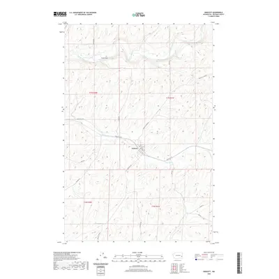
2020 Map of Endicott
USGS Topo · Published 2020About this map
Endicott serves as the central hub of this eastern Washington landscape, situated along the winding course of Rebel Flat Cr. This 2020 survey illustrates the town's position within a complex network of county roads that facilitate the region's agricultural transport, including Endicott W Hwy and Endicott-St John Rd. To the north, the terrain is defined by the larger Palouse River, which carves through the undulating topography. A notable point of transit is the Fisher Bridge, spanning the river near Kackman Rd. The map provides a detailed view of section lines and township boundaries, including t17n r41e and t16n r40e, which are essential for property researchers and local historians tracing land ownership in Whitman County.
Find a feature on this map
19 named features on this map. Tap any name to fly to it.
Don’t see what you’re looking for? This feature index may not catch every label — zoom into the map to look around manually.
Map Details
Editions of this 2020 Endicott Map
This is the sole edition of this map. No revisions or reprints were ever made.
Other maps of this area

1950 · La Crosse
USGS Topo · 1:62,500

1950 · Endicott
USGS Topo · 1:62,500

1952 · La Crosse
USGS Topo · 1:62,500

1955 · Pullman
USGS Topo · 1:250,000

1955 · Spokane
USGS Topo · 1:250,000

1958 · Spokane
USGS Topo · 1:250,000

1958 · Pullman
USGS Topo · 1:250,000

1964 · St. John
USGS Topo · 1:24,000

1964 · Texas Lake
USGS Topo · 1:24,000

1964 · Ewan
USGS Topo · 1:24,000