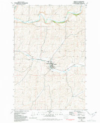
1981 Map of Endicott
USGS Topo · Published 1981About this map
The town of Endicott serves as the focal point of this 1981 survey of the Palouse region, where the Union Pacific railroad tracks parallel the course of Rebel Flat Creek. The area’s agricultural identity is clearly defined by infrastructure such as a Grain Elevator and a Storage Bin near the town center. To the north, the Palouse River winds through the landscape, marked by a Low-Water Ford and several small tributaries including Downing Creek. The terrain is characterized by the intricate contour patterns typical of eastern Washington's plateau, with localized sites of interest including a Cem and a Borrow Pit northwest of the main settlement. This map documents the intersection of rail transportation and the wheat-growing economy during the late twentieth century.
Find a feature on this map
15 named features on this map. Tap any name to fly to it.
Don’t see what you’re looking for? This feature index may not catch every label — zoom into the map to look around manually.
Map Details
Editions of this 1981 Endicott Map
This is the sole edition of this map. No revisions or reprints were ever made.
Other maps of this area

1950 · La Crosse
USGS Topo · 1:62,500

1950 · Endicott
USGS Topo · 1:62,500

1952 · La Crosse
USGS Topo · 1:62,500

1955 · Pullman
USGS Topo · 1:250,000

1955 · Spokane
USGS Topo · 1:250,000

1958 · Spokane
USGS Topo · 1:250,000

1958 · Pullman
USGS Topo · 1:250,000

1964 · St. John
USGS Topo · 1:24,000

1964 · Texas Lake
USGS Topo · 1:24,000

1964 · Ewan
USGS Topo · 1:24,000