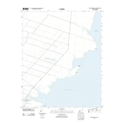
2011 Map of Engelhard East
USGS Topo · Published 2011About this map
Engelhard serves as the primary settlement on this coastal Hyde County landscape, situated where Far Creek meets the tidal waters. The terrain is defined by its proximity to the Pamlico Sound, with the coastline articulated by distinct features such as Gibbs Point, Shad Point, and Pingleton Point. This early 21st-century survey highlights an intricate network of drainage and canals across the low-lying interior, supporting the local agricultural and maritime economy. In addition to the town center, the infrastructure includes Liverman Airport and the primary transit corridor of Route 264. Moving north from the settlement, the map documents several water bodies including Kitty Creek, Waupopin Creek, and Broad Creek, illustrating the complex transition between the swampy mainland and the sound.
Find a feature on this map
14 named features on this map. Tap any name to fly to it.
Don’t see what you’re looking for? This feature index may not catch every label — zoom into the map to look around manually.
Map Details
Editions of this 2011 Engelhard East Map
This is the sole edition of this map. No revisions or reprints were ever made.
Other maps of this area

1943 · Columbia
USGS Topo · 1:125,000

1943 · Roanoke Island
USGS Topo · 1:125,000

1951 · Middletown Anchorage
USGS Topo · 1:24,000

1951 · Middletown
USGS Topo · 1:24,000

1951 · Engelhard West
USGS Topo · 1:24,000

1951 · Long Shoal Point
USGS Topo · 1:24,000

1951 · Engelhard East
USGS Topo · 1:24,000

1953 · Engelhard NW
USGS Topo · 1:24,000

1953 · Fairfield NE
USGS Topo · 1:24,000

1953 · Engelhard NE
USGS Topo · 1:24,000