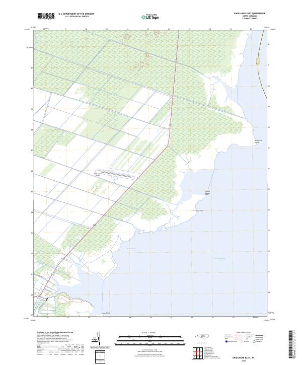
2022 Map of Engelhard East
USGS Topo · Published 2022About this map
Pamlico Sound dominates the southeastern quadrant of this coastal survey, where the low-lying marshlands of Hyde County meet the open water. The landscape is defined by a network of drainage canals and natural waterways like Broad Creek and Waupopin Creek, reflecting the area's intricate hydrologic management. A distinct line of prominent landmarks, including Juniper Swamp Point, Shad Point, and Gibbs Point, marks the shifting interface between the land and Berrys Bay.
Find a feature on this map
14 named features on this map. Tap any name to fly to it.
Don’t see what you’re looking for? This feature index may not catch every label — zoom into the map to look around manually.
Map Details
Editions of this 2022 Engelhard East Map
This is the sole edition of this map. No revisions or reprints were ever made.
Other maps of this area

1943 · Columbia
USGS Topo · 1:125,000

1943 · Roanoke Island
USGS Topo · 1:125,000

1951 · Middletown Anchorage
USGS Topo · 1:24,000

1951 · Middletown
USGS Topo · 1:24,000

1951 · Engelhard West
USGS Topo · 1:24,000

1951 · Long Shoal Point
USGS Topo · 1:24,000

1951 · Engelhard East
USGS Topo · 1:24,000

1953 · Engelhard NW
USGS Topo · 1:24,000

1953 · Fairfield NE
USGS Topo · 1:24,000

1953 · Engelhard NE
USGS Topo · 1:24,000