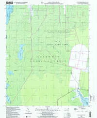
2000 Map of Engelhard NW
USGS Topo · Published 2002About this map
The Dare County Bombing Range occupies a significant portion of this coastal landscape, situated within a broader network of protected conservation areas. Located at the boundary between Dare and Hyde Counties, the terrain is defined by a dense mosaic of wetlands and tidal waters managed under the Alligator River National Wildlife Refuge and Dare State Game Land.
Find a feature on this map
20 named features on this map. Tap any name to fly to it.
Don’t see what you’re looking for? This feature index may not catch every label — zoom into the map to look around manually.
Map Details
Editions of this 2000 Engelhard NW Map
This is the sole edition of this map. No revisions or reprints were ever made.
Other maps of this area

1943 · Columbia
USGS Topo · 1:125,000

1943 · Roanoke Island
USGS Topo · 1:125,000

1951 · Engelhard West
USGS Topo · 1:24,000

1951 · Long Shoal Point
USGS Topo · 1:24,000

1951 · Engelhard East
USGS Topo · 1:24,000

1953 · Engelhard NW
USGS Topo · 1:24,000

1953 · Buffalo City
USGS Topo · 1:24,000

1953 · Fairfield NE
USGS Topo · 1:24,000

1953 · East Lake SE
USGS Topo · 1:24,000

1953 · Engelhard NE
USGS Topo · 1:24,000