
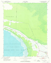
1951 Map of Engelhard West
USGS Topo · Published 1953About this map
Lake Mattamuskeet and its surrounding wetlands dominate this coastal North Carolina landscape, where the Mattamuskeet National Wildlife Refuge preserves a critical habitat for migratory birds. The map illustrates a highly managed hydrological system defined by the Jarvis Canal and several unnamed canals that facilitate drainage and navigation through the low-lying terrain of Fairfield and Lake Landing. Near the shoreline, the settlement of Engelhard sits at the junction of Highway 264 and the waters of Far Cr. Local heritage is anchored by landmarks such as Pleasant Grove Ch and the Fulford Cem, while a Lookout Tower stands as a sentinel along the refuge boundary. The survey reveals a distinct pattern of land use, where narrow agricultural plots extend toward the water, separated by a network of drainage ditches that speak to the region's long history of land reclamation and tidal management.
Find a feature on this map
15 named features on this map. Tap any name to fly to it.
Don’t see what you’re looking for? This feature index may not catch every label — zoom into the map to look around manually.
Map Details
Editions of this 1951 Engelhard West Map
4 editions found
Other maps of this area

1943 · Columbia
USGS Topo · 1:125,000

1943 · Roanoke Island
USGS Topo · 1:125,000

1951 · Middletown Anchorage
USGS Topo · 1:24,000

1951 · Middletown
USGS Topo · 1:24,000

1951 · New Holland
USGS Topo · 1:24,000

1951 · Engelhard East
USGS Topo · 1:24,000

1951 · Fairfield
USGS Topo · 1:24,000

1953 · Engelhard NW
USGS Topo · 1:24,000

1953 · Fairfield NE
USGS Topo · 1:24,000

1953 · Fairfield NW
USGS Topo · 1:24,000