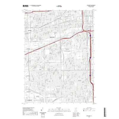
2021 Map of Englewood
USGS Topo · Published 2021About this map
Chicago's dense urban grid and industrial corridors define this landscape, anchored by the South Branch Chicago River and the significant industrial and maritime infrastructure around Cortez Basin. The map captures a transition between residential neighborhoods and massive institutional campuses, including medical and academic centers like Rush University, the University of Illinois at Chicago, and the Illinois Institute of Technology. Moving south, the urban fabric passes through historical districts such as Englewood and the rail-oriented neighborhood of Elsdon.
Find a feature on this map
235 named features on this map. Tap any name to fly to it.
Don’t see what you’re looking for? This feature index may not catch every label — zoom into the map to look around manually.
Map Details
Editions of this 2021 Englewood Map
This is the sole edition of this map. No revisions or reprints were ever made.
Other maps of this area

1889 · Chicago
USGS Topo · 1:62,500

1890 · Des Plaines
USGS Topo · 1:62,500

1891 · Chicago
USGS Topo · 1:62,500

1891 · Riverside
USGS Topo · 1:62,500

1892 · Calumet
USGS Topo · 1:62,500

1893 · Calumet
USGS Topo · 1:62,500

1893 · Riverside
USGS Topo · 1:62,500

1894 · Des Plaines
USGS Topo · 1:62,500

1900 · Chicago
USGS Topo · 1:62,500

1900 · Des Plaines
USGS Topo · 1:62,500