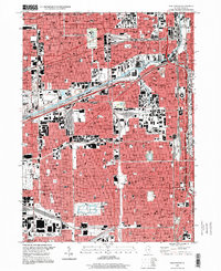
1997 Map of Englewood
USGS Topo · Published 1999About this map
The South Branch Chicago River and the Chicago Sanitary and Ship Canal anchor this dense urban grid, illustrating the industrial and transport arteries that shaped the city's growth. The map documents a landscape heavily defined by social and religious infrastructure, evidenced by the high concentration of parish schools such as St Anthony Sch, St Roman Sch, and St Maurice Sch. Large institutional footprints like the Cook County Dept of Corrections and the extensive Chicago Midway Airport grounds at the western edge reveal the transition between residential neighborhoods and massive regional facilities.
Find a feature on this map
118 named features on this map. Tap any name to fly to it.
Don’t see what you’re looking for? This feature index may not catch every label — zoom into the map to look around manually.
Map Details
Editions of this 1997 Englewood Map
This is the sole edition of this map. No revisions or reprints were ever made.
Other maps of this area

1889 · Chicago
USGS Topo · 1:62,500

1890 · Des Plaines
USGS Topo · 1:62,500

1891 · Chicago
USGS Topo · 1:62,500

1891 · Riverside
USGS Topo · 1:62,500

1892 · Calumet
USGS Topo · 1:62,500

1893 · Calumet
USGS Topo · 1:62,500

1893 · Riverside
USGS Topo · 1:62,500

1894 · Des Plaines
USGS Topo · 1:62,500

1900 · Chicago
USGS Topo · 1:62,500

1900 · Des Plaines
USGS Topo · 1:62,500