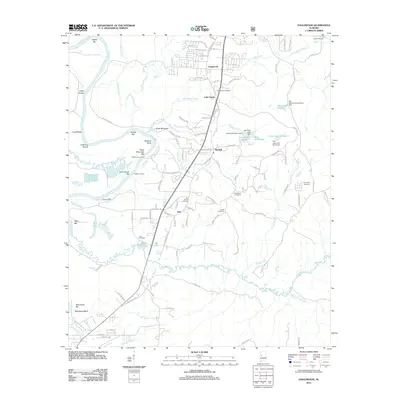
2011 Map of Englewood
USGS Topo · Published 2011About this map
The Black Warrior River defines the western edge of this landscape, its winding course marked by numerous sandbars and river landings such as McPherson Landing and Hulls Landing. This area of Tuscaloosa County exhibits a settlement pattern clustered around key road junctions and water bodies, with the communities of Englewood, Little Sandy, and Maxwell serving as local anchors. The map reveals a high density of burial grounds, including the Gilgal Cemetery and Big Sandy Cemetery, which offer valuable locations for genealogical research. Inland from the river, the terrain is shaped by the drainage of Big Sandy Creek and Cypress Creek. Family-named water features like Jack Duke Lake and the Cain Lake system suggest a history of private land management and local dam construction in the rolling hills south of the city.
Find a feature on this map
108 named features on this map. Tap any name to fly to it.
Don’t see what you’re looking for? This feature index may not catch every label — zoom into the map to look around manually.
Map Details
Editions of this 2011 Englewood Map
This is the sole edition of this map. No revisions or reprints were ever made.
Other maps of this area

1899 · Brookwood
USGS Topo · 1:125,000

1924 · Tuscaloosa
USGS Topo · 1:62,500

1926 · Tuscaloosa
USGS Topo · 1:62,500

1931 · Cottondale
USGS Topo · 1:48,000

1934 · Cottondale
USGS Topo · 1:62,500

1953 · Montgomery
USGS Topo · 1:250,000

1953 · Birmingham
USGS Topo · 1:250,000

1956 · Birmingham
USGS Topo · 1:250,000

1956 · Montgomery
USGS Topo · 1:250,000

1957 · Birmingham
USGS Topo · 1:250,000