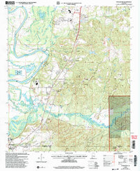
2002 Map of Englewood
USGS Topo · Published 2003About this map
The Black Warrior River carves a winding course through this landscape, defining the western edge of a region where river bottomlands meet the rising timberlands of the Talladega National Forest. Near the southern border, the ancient earthworks of Mound State Mon at Moundville highlight a site of profound archaeological significance, overlooking the river's floodplains. The map reveals a rural economy shaped by water and woods, with numerous Fish Hatcheries and Gravel Pits interspersed between small settlements. Local life is anchored by a network of country houses of worship, including Zion Hope Ch, Oak Grove Ch, and Antioch Ch. Along the river, Mcpherson Landing serves as a reminder of the historical importance of the waterway for transport, while the confluence of Big Sandy Creek and Little Sandy Creek creates a complex drainage system across the Tuscaloosa and Hale County line.
Find a feature on this map
38 named features on this map. Tap any name to fly to it.
Don’t see what you’re looking for? This feature index may not catch every label — zoom into the map to look around manually.
Map Details
Editions of this 2002 Englewood Map
This is the sole edition of this map. No revisions or reprints were ever made.
Other maps of this area

1899 · Brookwood
USGS Topo · 1:125,000

1924 · Tuscaloosa
USGS Topo · 1:62,500

1926 · Tuscaloosa
USGS Topo · 1:62,500

1931 · Cottondale
USGS Topo · 1:48,000

1934 · Cottondale
USGS Topo · 1:62,500

1953 · Montgomery
USGS Topo · 1:250,000

1953 · Birmingham
USGS Topo · 1:250,000

1956 · Birmingham
USGS Topo · 1:250,000

1956 · Montgomery
USGS Topo · 1:250,000

1957 · Birmingham
USGS Topo · 1:250,000