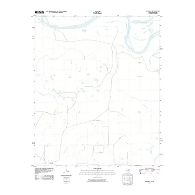
2010 Map of English
USGS Topo · Published 2010About this map
Red River floodplain dynamics dominate this landscape along the Texas-Oklahoma border, where fluvial features like the Dick Johnson Cut-Off and Forty-one Cut-off Lake reveal the shifting path of the river over time. In the southern portion of the quadrangle, the small community of English sits at the junction of FM 1699 and FM 114, surrounded by a network of rural county roads such as Co RD 3280 and Co RD 3345. The area is characterized by numerous small water bodies and seasonal drainages, including Pecan Bayou and Grassy Lake. Local history is anchored by the Riverview Cemetery located near the river bluffs, while the terrain is further defined by the convergences of West Beaverdam Creek and Beaverdam Creek in the south and Pecan Springs in the central wetlands.
Find a feature on this map
19 named features on this map. Tap any name to fly to it.
Don’t see what you’re looking for? This feature index may not catch every label — zoom into the map to look around manually.
Map Details
Editions of this 2010 English Map
This is the sole edition of this map. No revisions or reprints were ever made.
Other maps of this area

1950 · Acworth
USGS Topo · 1:24,000

1950 · De Kalb NW
USGS Topo · 1:24,000

1950 · White Rock
USGS Topo · 1:24,000

1950 · Haworth
USGS Topo · 1:24,000

1950 · Oak Grove
USGS Topo · 1:24,000

1950 · Annona
USGS Topo · 1:24,000

1951 · Idabel SE
USGS Topo · 1:24,000

1951 · English
USGS Topo · 1:24,000

1951 · Annona
USGS Topo · 1:24,000

1951 · White Rock
USGS Topo · 1:24,000