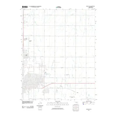
2010 Map of Enid East
USGS Topo · Published 2010About this map
North Enid and the eastern suburbs of the Garfield County seat are shown during a period of steady residential and industrial expansion. The landscape is defined by the drainage systems of Skeleton Creek and Boggy Creek, which carve through the grid-iron road network of the southern Great Plains. Aviation infrastructure is prominent, with the Enid Woodring Municipal Airport and the specialized North/Hirst Aero Spray Airport serving the region's agricultural and civil needs. In the northeast, Red Rock Creek winds through less developed acreage, while the Sooner Trend corridor indicates the area's ongoing connection to energy production. Local history is anchored by sites like Memorial Park Cemetery and the small community of Shea, providing specific points of interest for genealogists tracing family locations in this portion of Oklahoma.
Find a feature on this map
37 named features on this map. Tap any name to fly to it.
Don’t see what you’re looking for? This feature index may not catch every label — zoom into the map to look around manually.
Map Details
Editions of this 2010 Enid East Map
This is the sole edition of this map. No revisions or reprints were ever made.
Other maps of this area

1955 · Enid West
USGS Topo · 1:24,000

1955 · Enid East
USGS Topo · 1:24,000

1955 · Enid
USGS Topo · 1:250,000

1956 · Garber
USGS Topo · 1:62,500

1956 · Enid
USGS Topo · 1:62,500

1958 · Enid
USGS Topo · 1:250,000

1968 · Hillsdale
USGS Topo · 1:24,000

1968 · Hunter
USGS Topo · 1:24,000

1968 · Kremlin
USGS Topo · 1:24,000
1982 · Waukomis
USGS Topo · 1:24,000