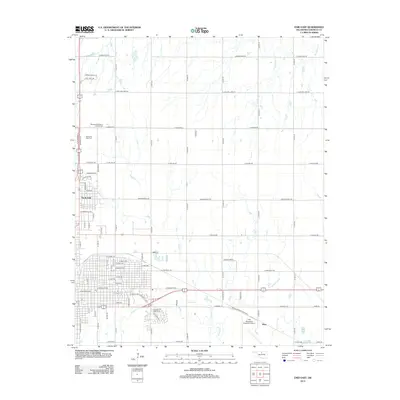
2012 Map of Enid East
USGS Topo · Published 2012About this map
Skeleton Creek and its tributaries define the drainage of this Garfield County landscape, which includes the growing eastern suburbs of North Enid and the small community of Shea. The area is a nexus of civic and regional infrastructure, anchored by the Enid Woodring Regional Airport and the expansive Enid Woodring Municipal grounds. For those researching local heritage, the map identifies significant burial sites including the Memorial Park Cemetery and the Mennonite Brethren of Enid Cemetery, which reflect the area's cultural and religious history.
Find a feature on this map
85 named features on this map. Tap any name to fly to it.
Don’t see what you’re looking for? This feature index may not catch every label — zoom into the map to look around manually.
Map Details
Editions of this 2012 Enid East Map
This is the sole edition of this map. No revisions or reprints were ever made.
Other maps of this area

1955 · Enid West
USGS Topo · 1:24,000

1955 · Enid East
USGS Topo · 1:24,000

1955 · Enid
USGS Topo · 1:250,000

1956 · Garber
USGS Topo · 1:62,500

1956 · Enid
USGS Topo · 1:62,500

1958 · Enid
USGS Topo · 1:250,000

1968 · Hillsdale
USGS Topo · 1:24,000

1968 · Hunter
USGS Topo · 1:24,000

1968 · Kremlin
USGS Topo · 1:24,000
1982 · Waukomis
USGS Topo · 1:24,000