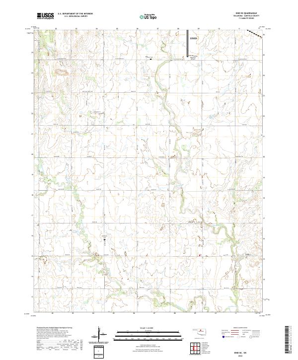
2022 Map of Enid SE
USGS Topo · Published 2022About this map
Enid's southeastern reaches transition from municipal infrastructure to the agricultural grid of Garfield County. The landscape is defined by the winding paths of Skeleton Cr and Hackberry Cr, which break the geometric precision of section roads like E Southgate Rd and S 42nd St. Transport and aviation history intersect here at the Enid Woodring Regional Airport, a significant local landmark situated near the northern edge of the survey. For those tracing family history or local land use, the map identifies small, established sites such as Bethany Cem and Hackberry Cem, which remain as quiet anchors in a region largely dedicated to open acreage and drainage networks. The thoroughfare Leona Mitchell Blvd serves as a primary western artery, connecting the suburban outskirts to the broader Oklahoma plains.
Find a feature on this map
49 named features on this map. Tap any name to fly to it.
Don’t see what you’re looking for? This feature index may not catch every label — zoom into the map to look around manually.
Map Details
Editions of this 2022 Enid SE Map
This is the sole edition of this map. No revisions or reprints were ever made.
Other maps of this area

1893 · Lovell
USGS Topo · 1:62,500

1893 · Hennessey
USGS Topo · 1:62,500

1955 · Enid West
USGS Topo · 1:24,000

1955 · Enid East
USGS Topo · 1:24,000

1955 · Enid
USGS Topo · 1:250,000

1956 · Garber
USGS Topo · 1:62,500

1956 · Hennessey
USGS Topo · 1:62,500

1956 · Enid
USGS Topo · 1:62,500

1958 · Enid
USGS Topo · 1:250,000

1974 · Marshall West
USGS Topo · 1:24,000