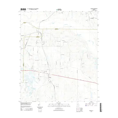
2014 Map of Enigma
USGS Topo · Published 2014About this map
The town of Enigma serves as the focal point for this section of South Georgia, where the crossing of Us-82 and local routes like Enigma Turner Church Rd define the local geography. To the north, the Alapaha River meanders through a landscape defined by several smaller water bodies, including Ferry Lake and Hammock Lake. This 2014 survey reveals a territory marked by family names on its cemeteries and roads, such as Paulks Cem and Fate Barnes Rd, reflecting long-standing local ties. The hydrography is particularly intricate south of town, where Hardy Mill Creek flows near Hardy Millpond, and a series of lakes—Lake Patrick, Lake Bobben, and the distinctively shaped Horseshoe S Lake—dot the Tift and Berrien county border. At the northeastern corner, the settlement of Riverbend sits near the banks of the Alapaha, adjacent to Riverbend Cem.
Find a feature on this map
86 named features on this map. Tap any name to fly to it.
Don’t see what you’re looking for? This feature index may not catch every label — zoom into the map to look around manually.
Map Details
Editions of this 2014 Enigma Map
This is the sole edition of this map. No revisions or reprints were ever made.
Other maps of this area

1953 · Waycross
USGS Topo · 1:250,000

1958 · Waycross
USGS Topo · 1:250,000

1972 · Tenmile Bay
USGS Topo · 1:24,000

1972 · Ocilla East
USGS Topo · 1:24,000

1973 · Ocilla West
USGS Topo · 1:24,000

1973 · Sapps Lake
USGS Topo · 1:24,000

1973 · Waterloo
USGS Topo · 1:24,000

1973 · Enigma
USGS Topo · 1:24,000

1973 · Lenox
USGS Topo · 1:24,000

1973 · Tifton East
USGS Topo · 1:24,000