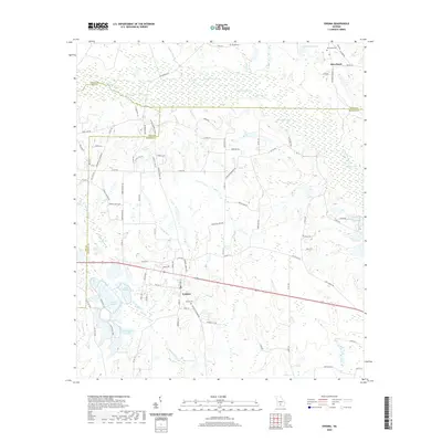
2020 Map of Enigma
USGS Topo · Published 2020About this map
Enigma serves as the focal point of this South Georgia landscape, situated at the crossroads of Berrien, Tift, and Irwin counties. The settlement is defined by its grid of local streets, the Enigma Cem, and its proximity to a dense network of blackwater streams and small lakes. To the north, the Alapaha River meanders through swampy lowlands, joined by tributaries such as Island Field Br and Gum Cr. The abundance of named water bodies, including Hammock Lake, Lake Patrick, and Horseshoe S Lake, illustrates a terrain dominated by the natural drainage patterns of the coastal plain.
Find a feature on this map
100 named features on this map. Tap any name to fly to it.
Don’t see what you’re looking for? This feature index may not catch every label — zoom into the map to look around manually.
Map Details
Editions of this 2020 Enigma Map
This is the sole edition of this map. No revisions or reprints were ever made.
Other maps of this area

1953 · Waycross
USGS Topo · 1:250,000

1958 · Waycross
USGS Topo · 1:250,000

1972 · Tenmile Bay
USGS Topo · 1:24,000

1972 · Ocilla East
USGS Topo · 1:24,000

1973 · Ocilla West
USGS Topo · 1:24,000

1973 · Sapps Lake
USGS Topo · 1:24,000

1973 · Waterloo
USGS Topo · 1:24,000

1973 · Enigma
USGS Topo · 1:24,000

1973 · Lenox
USGS Topo · 1:24,000

1973 · Tifton East
USGS Topo · 1:24,000