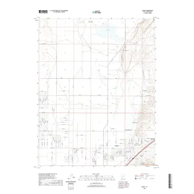
2020 Map of Enoch
USGS Topo · Published 2020About this map
Enoch serves as a modern focal point in the eastern reaches of Cedar Valley, where the residential grids of Iron County meet the rising elevations of the Hurricane Cliffs. This 2020 survey documents the complex intersection of geological forces and human settlement, with the prominent Hurricane Fault running north-south through the terrain. Evidence of the area's pioneer heritage is preserved at Fort Johnson and the Enoch Cem, providing valuable touchpoints for genealogists and local historians. To the north, the ephemeral Rush Lake and the drainage of Johnson Cr define the lower valley landscape, while the topography steepens sharply to the east at Black Point and Clarks Canyon. A dense network of modern roads, such as W Midvalley Rd and Village Green Rd, reflects the steady expansion of the community across this arid landscape.
Find a feature on this map
48 named features on this map. Tap any name to fly to it.
Don’t see what you’re looking for? This feature index may not catch every label — zoom into the map to look around manually.
Map Details
Editions of this 2020 Enoch Map
This is the sole edition of this map. No revisions or reprints were ever made.
Other maps of this area

1885 · St. George
USGS Topo · 1:250,000

1886 · Kanab
USGS Topo · 1:250,000

1891 · St. George
USGS Topo · 1:250,000

1949 · Cedar City NW
USGS Topo · 1:24,000

1950 · Cedar City NW
USGS Topo · 1:24,000

1950 · Enoch
USGS Topo · 1:24,000

1950 · Cedar City
USGS Topo · 1:24,000

1950 · Enoch
USGS Topo · 1:62,500

1950 · Cedar City
USGS Topo · 1:62,500

1950 · The Three Peaks
USGS Topo · 1:24,000