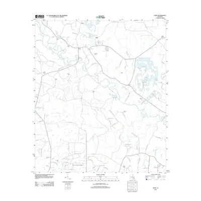
2012 Map of Enon
USGS Topo · Published 2012About this map
The winding course of the Bogue Chitto river defines the rural character of Washington Parish in this early 21st-century survey. Centered on the community of Enon, the landscape is a network of family-named creeks and drainage branches including Mill Cr, House Cr, and Thigpen Cr. The map is particularly valuable for genealogists, documenting numerous local burial sites such as Magee Cem, Cordelia Cem, and the Sharp Chapel Cem. These points of interest, alongside the Enon Lookout Tower and smaller settlements like Zona and Willis, illustrate a deeply rooted residential pattern. Small aviation sites like Corkern Airport and Warner-Thunder Hill Airport are interspersed among the timbered terrain, while the southern boundary reaches toward the Little Bogue Falaya river system.
Find a feature on this map
116 named features on this map. Tap any name to fly to it.
Don’t see what you’re looking for? This feature index may not catch every label — zoom into the map to look around manually.
Map Details
Editions of this 2012 Enon Map
This is the sole edition of this map. No revisions or reprints were ever made.
Other maps of this area

1939 · Zona
USGS Topo · 1:31,680

1942 · Onville
USGS Topo · 1:31,680

1942 · Waldheim
USGS Topo · 1:31,680

1942 · Thigpen
USGS Topo · 1:31,680

1942 · Talisheek
USGS Topo · 1:31,680

1942 · Rio
USGS Topo · 1:31,680

1949 · Bogalusa West
USGS Topo · 1:31,680

1950 · Folsom
USGS Topo · 1:31,680

1950 · Franklinton
USGS Topo · 1:31,680

1953 · Mobile
USGS Topo · 1:250,000