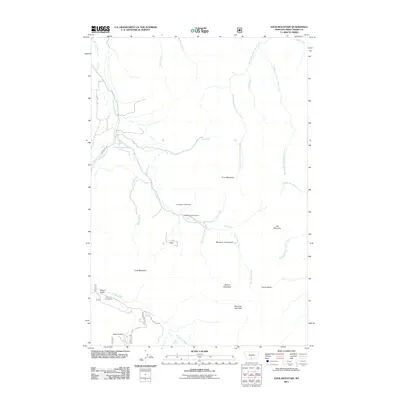
2011 Map of Enos Mountain
USGS Topo · Published 2011About this map
The Farnsworth Homestead and Seasongood Homestead occupy the central drainage of Elk Creek in this portion of Montana, illustrating the pattern of land claims along the valley floors. In the southern reaches, the McKinsey Homestead is situated near Wright Gulch where E Boulder Rd follows the course of the East Boulder River. This landscape is defined by high peaks and deeply cut canyons, such as Skookum Joe Canyon and the surrounding heights of Enos Mountain and Morning Star Peak. The hydrologic network is dense with tributaries feeding the Upper Deer Creek system, including the West Fork Upper Deer Creek and Middle Fork Upper Deer Creek. These waterways and named peaks, including Long Mountain and Boone Mountain, provide a clear picture of the topography and land use in Sweet Grass County during the early 21st century.
Find a feature on this map
30 named features on this map. Tap any name to fly to it.
Don’t see what you’re looking for? This feature index may not catch every label — zoom into the map to look around manually.
Map Details
Editions of this 2011 Enos Mountain Map
This is the sole edition of this map. No revisions or reprints were ever made.
Other maps of this area

1891 · Livingston
USGS Topo · 1:250,000

1891 · Big Timber
USGS Topo · 1:125,000

1893 · Livingston
USGS Topo · 1:250,000

1893 · Big Timber
USGS Topo · 1:125,000

1898 · Granite Mountain District
USGS Topo · 1:125,000

1932 · Nye No 2
USGS Topo · 1:48,000

1939 · Mt Wood
USGS Topo · 1:62,500

1941 · Mt. Wood
USGS Topo · 1:62,500

1941 · Mt Douglas
USGS Topo · 1:62,500

1943 · Mt Douglas
USGS Topo · 1:62,500