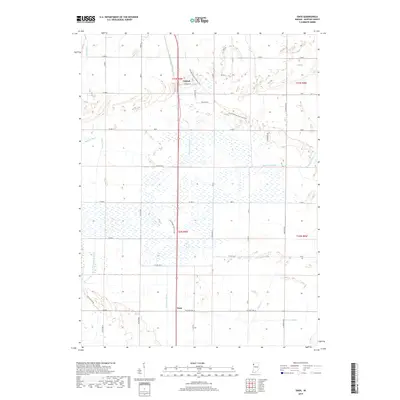
2019 Map of Enos
USGS Topo · Published 2019About this map
Enos and Conrad anchor this portion of Newton County, characterized by a complex network of artificial waterways that drain the low-lying terrain. The landscape is defined by its agricultural and conservation efforts, evidenced by the numerous ditches such as Beaver Lake Ditch, Bogus Island Ditch, and Mud Lake Ditch. These channels represent a long history of water management designed to reclaim and manage the wet prairie of northwest Indiana.
Find a feature on this map
54 named features on this map. Tap any name to fly to it.
Don’t see what you’re looking for? This feature index may not catch every label — zoom into the map to look around manually.
Map Details
Editions of this 2019 Enos Map
This is the sole edition of this map. No revisions or reprints were ever made.
Other maps of this area

1922 · Momence
USGS Topo · 1:62,500

1924 · Momence
USGS Topo · 1:62,500

1935 · Watseka
USGS Topo · 1:48,000

1939 · Watseka
USGS Topo · 1:62,500

1953 · Chicago
USGS Topo · 1:250,000

1953 · Danville
USGS Topo · 1:250,000

1955 · Danville
USGS Topo · 1:250,000

1956 · Danville
USGS Topo · 1:250,000

1957 · Chicago
USGS Topo · 1:250,000

1959 · Schneider
USGS Topo · 1:24,000