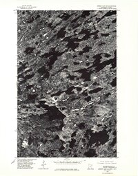
1976 Map of Ensign Lake SE
USGS Topo · Published 1979About this map
Ensign Lake and the surrounding wilderness of northern Minnesota are captured in this mid-1970s orthophotomap, which uses aerial photography to detail a landscape defined by water and rock rather than roads or towns. The international boundary between the United States and Canada is visible where it traverses the connected waters of Knife Lake and Carp Lake, following the historical path of the Ontario and Minnesota border. This specific survey provides a clear view of the complex shoreline of Ima Lake and the narrow corridor of the Knife River, illustrating the glacially-sculpted terrain of the Boundary Waters region. Unlike traditional topographic maps, the orthophoto format reveals the literal texture of the forest canopy and exposed Canadian Shield, highlighting the isolation of these interconnected lake systems.
Find a feature on this map
7 named features on this map. Tap any name to fly to it.
Don’t see what you’re looking for? This feature index may not catch every label — zoom into the map to look around manually.
Map Details
Editions of this 1976 Ensign Lake SE Map
This is the sole edition of this map. No revisions or reprints were ever made.
Other maps of this area

1954 · Two Harbors
USGS Topo · 1:250,000

1957 · Two Harbors
USGS Topo · 1:250,000

1957 · Ensign Lake
USGS Topo · 1:62,500

1957 · Quetico
USGS Topo · 1:250,000

1958 · Two Harbors
USGS Topo · 1:250,000

1959 · Kekekabic Lake
USGS Topo · 1:24,000

1959 · Dutton Lake
USGS Topo · 1:24,000

1960 · Alice Lake
USGS Topo · 1:24,000

1964 · Two Harbors
USGS Topo · 1:250,000

1968 · Quetico
USGS Topo · 1:250,000