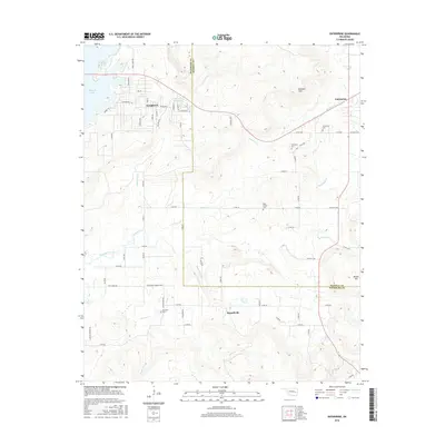
2016 Map of Enterprise
USGS Topo · Published 2016About this map
Eufaula Lake defines the western edge of this landscape, where the waters meet the hills of Pittsburg and Haskell counties. The terrain is marked by significant elevations like Brooken Mtn and Beaver Mtn, which overlook a network of watercourses including Brooken Cr and Longtown Creek. Settlement patterns are concentrated around Longtown, Enterprise, and Russellville, reflecting the rural character of this portion of eastern Oklahoma. Local history is anchored by several burial sites, such as Enterprise Cem, West Liberty Cem, and Palestine Cem. A notable piece of local infrastructure is the Ware Farm Landing Field, situated near the confluence of several rural routes and House Cr. The map captures the interface between managed water resources, such as the 121003 Reservoir, and the natural drainage basins that flow toward the larger lake system.
Find a feature on this map
69 named features on this map. Tap any name to fly to it.
Don’t see what you’re looking for? This feature index may not catch every label — zoom into the map to look around manually.
Map Details
Editions of this 2016 Enterprise Map
This is the sole edition of this map. No revisions or reprints were ever made.
Other maps of this area

1900 · Sansbois
USGS Topo · 1:125,000

1900 · Canadian
USGS Topo · 1:125,000

1909 · Sans Bois
USGS Topo · 1:125,000

1911 · Sansbois
USGS Topo · 1:125,000

1946 · Fort Smith
USGS Topo · 1:250,000

1963 · Porum
USGS Topo · 1:24,000

1963 · Eufaula
USGS Topo · 1:24,000

1963 · Texanna
USGS Topo · 1:24,000

1965 · Fort Smith
USGS Topo · 1:250,000

1967 · Fort Smith
USGS Topo · 1:250,000