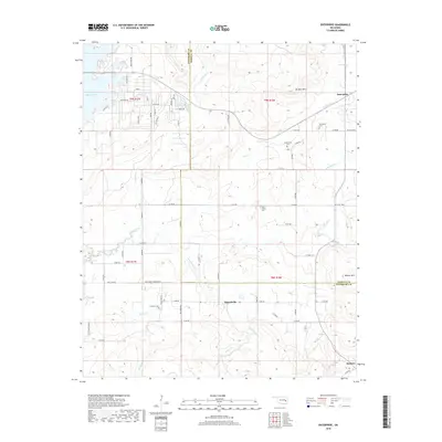
2018 Map of Enterprise
USGS Topo · Published 2018About this map
Eufaula Lake dominates the northwest corner of this Oklahoma landscape, its fingers reaching into the hilly terrain where the borders of Pittsburg and Haskell counties meet. The small community of Enterprise serves as a local hub near Brooken Mtn, while further south, the settlement of Russellville sits at a crossroads near Russellville Br. This area exhibits a transition from the water-influenced shoreline developments to the traditional agricultural and ranching interior, marked by features like the Ware Farm Landing Field. Genealogists will find significant local value in the presence of several rural burial sites, including Enterprise Cem, West Liberty Cem, and Palestine Cem. The topography is defined by prominent elevations such as Beaver Mtn and a network of drainages including Longtown Creek and Brooken Cr, illustrating the area's natural drainage into the larger reservoir system.
Find a feature on this map
71 named features on this map. Tap any name to fly to it.
Don’t see what you’re looking for? This feature index may not catch every label — zoom into the map to look around manually.
Map Details
Editions of this 2018 Enterprise Map
This is the sole edition of this map. No revisions or reprints were ever made.
Other maps of this area
1900 · Sansbois
USGS Topo · 1:125,000
1900 · Canadian
USGS Topo · 1:125,000
1909 · Sans Bois
USGS Topo · 1:125,000
1911 · Sansbois
USGS Topo · 1:125,000
1946 · Fort Smith
USGS Topo · 1:250,000
1963 · Porum
USGS Topo · 1:24,000
1963 · Eufaula
USGS Topo · 1:24,000
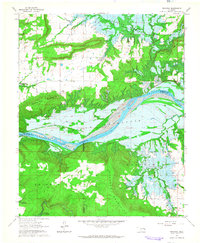
1963 · Texanna
USGS Topo · 1:24,000
1965 · Fort Smith
USGS Topo · 1:250,000
1967 · Fort Smith
USGS Topo · 1:250,000