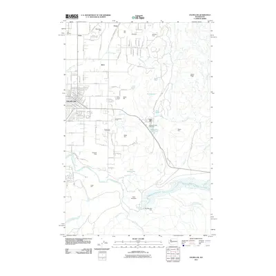
2011 Map of Enumclaw
USGS Topo · Published 2011About this map
The city of Enumclaw serves as the focal point of this King County survey, illustrating the transition from organized street grids to the industrial and natural landscapes of the Cascade foothills. To the north and east, smaller settlements like Krain, Veazie, and Birch sit among a terrain defined by significant elevation markers such as Stanridge Hill and Pinnacle Peak. The local economy and infrastructure are clearly tied to water and timber, evidenced by the Upper Mill and the White River Mill Pond Dam along the Boise Creek drainage.
Find a feature on this map
36 named features on this map. Tap any name to fly to it.
Don’t see what you’re looking for? This feature index may not catch every label — zoom into the map to look around manually.
Map Details
Editions of this 2011 Enumclaw Map
This is the sole edition of this map. No revisions or reprints were ever made.
Other maps of this area

1897 · Tacoma
USGS Topo · 1:125,000

1900 · Tacoma
USGS Topo · 1:125,000

1913 · Cedar Lake
USGS Topo · 1:125,000

1942 · Lake Tapps
USGS Topo · 1:62,500

1944 · Lake Tapps
USGS Topo · 1:62,500

1949 · Black Diamond
USGS Topo · 1:24,000

1953 · Eagle Gorge
USGS Topo · 1:24,000

1953 · Cumberland
USGS Topo · 1:24,000
1956 · Buckley
USGS Topo · 1:24,000
1956 · Wilkeson
USGS Topo · 1:24,000