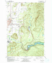
1993 Map of Enumclaw
USGS Topo · Published 1993About this map
Enumclaw and Buckley anchor this landscape, where the White River carves a deep valley at the boundary of King County and Pierce Co. The 1993 edition reveals a transition from the urban street grid of Enumclaw to the engineered control of the Mud Mountain Dam and Mud Mountain Lake. Between these points, the land is defined by prominent topographical landmarks like Pinnacle Peak and Baldy Hill, while remnants of industrial history are visible in the Old Railroad Grade and several extractive sites such as Vezzey Quarry. Local institutions like the Rainier State School and White River Ranger Sta provide a sense of the town's civic footprint. Notable smaller settlements like Krain appear alongside numerous rural schools, including Byron Kibler Sch and Smith Sch, documenting the community's mid-century educational infrastructure.
Find a feature on this map
53 named features on this map. Tap any name to fly to it.
Don’t see what you’re looking for? This feature index may not catch every label — zoom into the map to look around manually.
Map Details
Editions of this 1993 Enumclaw Map
This is the sole edition of this map. No revisions or reprints were ever made.
Other maps of this area

1897 · Tacoma
USGS Topo · 1:125,000

1900 · Tacoma
USGS Topo · 1:125,000

1913 · Cedar Lake
USGS Topo · 1:125,000

1942 · Lake Tapps
USGS Topo · 1:62,500

1944 · Lake Tapps
USGS Topo · 1:62,500

1949 · Black Diamond
USGS Topo · 1:24,000

1953 · Eagle Gorge
USGS Topo · 1:24,000

1953 · Cumberland
USGS Topo · 1:24,000
1956 · Buckley
USGS Topo · 1:24,000
1956 · Wilkeson
USGS Topo · 1:24,000